WWII defences of North Wales: Gwespyr Royal Naval Radar Station (1)
Introduction
The photograph on this page of WWII defences of North Wales: Gwespyr Royal Naval Radar Station (1) by Mike Searle as part of the Geograph project.
The Geograph project started in 2005 with the aim of publishing, organising and preserving representative images for every square kilometre of Great Britain, Ireland and the Isle of Man.

There are currently over 7.5m images from over 14,400 individuals and you can help contribute to the project by visiting https://www.geograph.org.uk
WWII defences of North Wales: Gwespyr Royal Naval Radar Station (1)
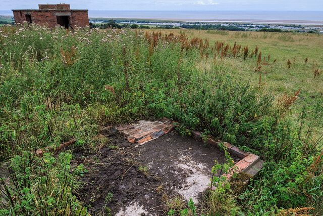
Image: © Mike Searle Taken: 31 Jul 2021
Overlooking the approaches to the mouths of the Dee and Mersey estuaries, the station was primarily used in a surface and coastal watching role, plotting ship movements, and keeping a close watch for enemy submarines. The station was one of only four other stations, all of which were in northern Scotland, and was only operational for a short time between December 1942 and October 1944. It was equipped with a type T273 Coastal Defence centimetric radar using a rotating parabolic dish antenna. Some of the buildings associated with the station still survive, albeit as ruins. The base of what was the guard picket post can be seen here in the foreground at the entrance to the site. Image
Images are licensed for reuse under creativecommons.org/licenses/by-sa/2.0
Image Location
Latitude
53.337616
Longitude
-3.341085