Broad Street Library, Foleshill, Coventry
Introduction
The photograph on this page of Broad Street Library, Foleshill, Coventry by A J Paxton as part of the Geograph project.
The Geograph project started in 2005 with the aim of publishing, organising and preserving representative images for every square kilometre of Great Britain, Ireland and the Isle of Man.

There are currently over 7.5m images from over 14,400 individuals and you can help contribute to the project by visiting https://www.geograph.org.uk
Broad Street Library, Foleshill, Coventry
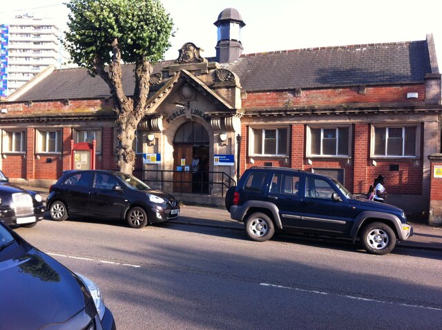
Image: © A J Paxton Taken: 16 Aug 2021
One of three Carnegie libraries in Coventry; the others are on Earlsdon Avenue North in Earlsdon and on Walsgrave Road in Stoke. Carnegie libraries were built with money given by the Scottish-American business magnate Andrew Carnegie; over 2000 were constructed between 1886 and 1929, 660 of them in Britain & Ireland. The libraries were an expression of his belief in self-help and were deliberately built in prominent public places, typically with a grand entrance with steps, symbolising the raising up of the reader through learning. https://en.wikipedia.org/wiki/Carnegie_library The city of Coventry approached Carnegie and his foundation in 1910 for funding to build three branch libraries, and was awarded £10000, on condition the city provided the land and an additional rate (tax) to fund the running of the libraries, which it did the following year. https://www.coventry.gov.uk/downloads/file/20370/req00916 The Coventry libraries are built in red brick with sandstone dressings in a baroque style. They are all still in use as public libraries. Broad Street Library was burned down by arsonists in 2003 and most of the stock - which included the city's main collection of multicultural library books and materials - was destroyed. The library was subsequently rebuilt and restocked. See this Coventry Telegraph report https://www.coventrytelegraph.net/news/coventry-news/libraries-set-2m-new-chapter-3147790 .
Images are licensed for reuse under creativecommons.org/licenses/by-sa/2.0
Image Location
Latitude
52.426811
Longitude
-1.496261