Trent and Mersey Canal in Stoke-on-Trent
Introduction
The photograph on this page of Trent and Mersey Canal in Stoke-on-Trent by Roger Kidd as part of the Geograph project.
The Geograph project started in 2005 with the aim of publishing, organising and preserving representative images for every square kilometre of Great Britain, Ireland and the Isle of Man.

There are currently over 7.5m images from over 14,400 individuals and you can help contribute to the project by visiting https://www.geograph.org.uk
Trent and Mersey Canal in Stoke-on-Trent
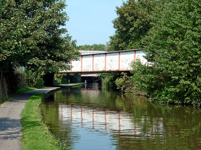
Image: © Roger Kidd Taken: 10 Sep 2014
Five hundred metres north-west of Stoke-on-Trent railway station, this is the Trent and Mersey Canal approaching Cockshutts Lock, No 37. In the foreground is a disused railway bridge which used to carry a line to serve early 20th century factories. I don't know when it was decommissioned. Beyond it, the West Coast Main Line (Stafford to Manchester Branch) crosses the canal by Cockshutt Lock, and above is a footbridge crossing the railway.
Images are licensed for reuse under creativecommons.org/licenses/by-sa/2.0
Image Location
Latitude
53.011338
Longitude
-2.188051