St Michael's Madeley Benchmark
Introduction
The photograph on this page of St Michael's Madeley Benchmark by Anthony Rowley as part of the Geograph project.
The Geograph project started in 2005 with the aim of publishing, organising and preserving representative images for every square kilometre of Great Britain, Ireland and the Isle of Man.

There are currently over 7.5m images from over 14,400 individuals and you can help contribute to the project by visiting https://www.geograph.org.uk
St Michael's Madeley Benchmark
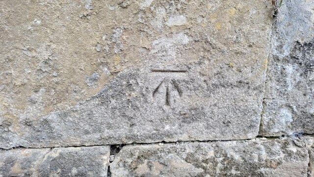
Image: © Anthony Rowley Taken: 15 Jul 2021
The Cut Ordnance Survey Benchmark adjacent to St Michael's Church in Madeley. It is cut into the roadside wall on Church Street. Last levelled by the OS in 1979. What3Words: obvious.apes.jugs
Images are licensed for reuse under creativecommons.org/licenses/by-sa/2.0
Image Location
Latitude
52.634117
Longitude
-2.450427