Halling Parish Sign
Introduction
The photograph on this page of Halling Parish Sign by Philip Halling as part of the Geograph project.
The Geograph project started in 2005 with the aim of publishing, organising and preserving representative images for every square kilometre of Great Britain, Ireland and the Isle of Man.

There are currently over 7.5m images from over 14,400 individuals and you can help contribute to the project by visiting https://www.geograph.org.uk
Halling Parish Sign
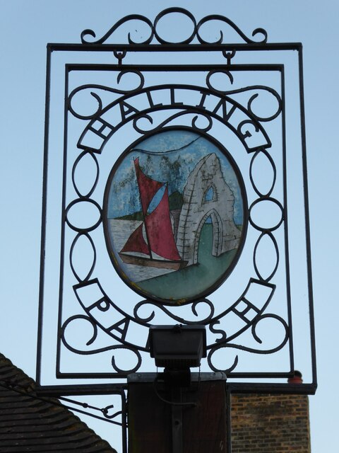
Image: © Philip Halling Taken: 10 Aug 2021
The sign shows a sailing boat on the nearby Medway, there used to be a ferry crossing, and the ruin represents part of the Bishops Palace at Rochester.
Images are licensed for reuse under creativecommons.org/licenses/by-sa/2.0
Image Location
Latitude
51.349331
Longitude
0.446531