Bournemouth Corporation trolleybus on Cranleigh Road ? 1969
Introduction
The photograph on this page of Bournemouth Corporation trolleybus on Cranleigh Road ? 1969 by Alan Murray-Rust as part of the Geograph project.
The Geograph project started in 2005 with the aim of publishing, organising and preserving representative images for every square kilometre of Great Britain, Ireland and the Isle of Man.

There are currently over 7.5m images from over 14,400 individuals and you can help contribute to the project by visiting https://www.geograph.org.uk
Bournemouth Corporation trolleybus on Cranleigh Road ? 1969
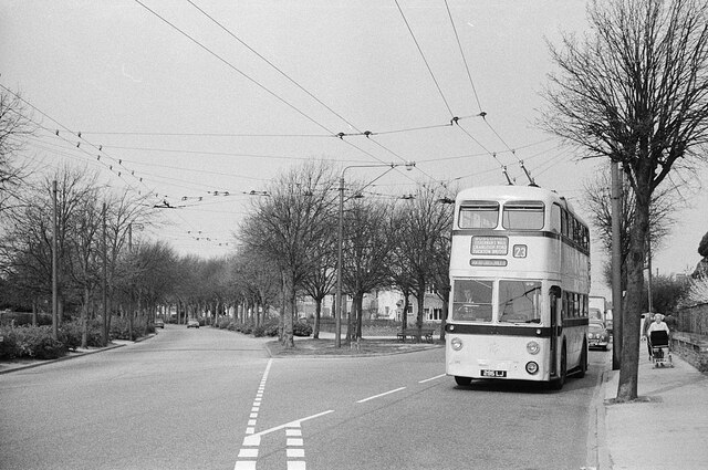
Image: © Alan Murray-Rust Taken: 19 Apr 1969
On service 23 to Tuckton Bridge where it would change to service 22 to return to Bournemouth Square via Southbourne. This is the junction of Cranleigh Road with Carbery Avenue where there was a circle of wiring enabling vehicles to turn back from either direction, but only used in special circumstances. The junction has since been remodelled with all traffic using the roadway behind the island with its trees. http://www.geograph.org.uk/photo/719537 http://www.geograph.org.uk/photo/3402382 This is one of a series of views featuring buses in the 60s, 70s, and 80s. http://www.geograph.org.uk/search.php?i=137652761
Images are licensed for reuse under creativecommons.org/licenses/by-sa/2.0
Image Location
Latitude
50.728791
Longitude
-1.796207