Disused pump house
Introduction
The photograph on this page of Disused pump house by Richard Sutcliffe as part of the Geograph project.
The Geograph project started in 2005 with the aim of publishing, organising and preserving representative images for every square kilometre of Great Britain, Ireland and the Isle of Man.

There are currently over 7.5m images from over 14,400 individuals and you can help contribute to the project by visiting https://www.geograph.org.uk
Disused pump house
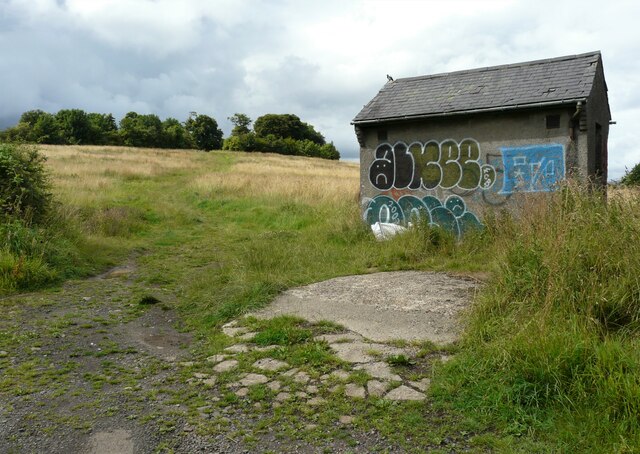
Image: © Richard Sutcliffe Taken: 8 Aug 2021
The former pump house is located just inside a field beside the A810, Duntocher Road. It is covered in graffiti. In the distance is the tree-topped Castle Hill, the site of a Roman fort on the Antonine Wall; and a Scheduled Monument http://portal.historicenvironment.scot/designation/SM6839.
Images are licensed for reuse under creativecommons.org/licenses/by-sa/2.0
Image Location
Latitude
55.925628
Longitude
-4.359984