Church of St. Silas, Nunhead
Introduction
The photograph on this page of Church of St. Silas, Nunhead by David Wright as part of the Geograph project.
The Geograph project started in 2005 with the aim of publishing, organising and preserving representative images for every square kilometre of Great Britain, Ireland and the Isle of Man.

There are currently over 7.5m images from over 14,400 individuals and you can help contribute to the project by visiting https://www.geograph.org.uk
Church of St. Silas, Nunhead
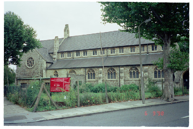
Image: © David Wright Taken: 6 Sep 1998
Church of St. Silas, Ivydale Road, Nunhead. Photo taken 6 Sep 1998. This church has now been demolished. NB: The Grid 75 Northing runs through the site and picture could equally have been in TQ3575. For a picture of the replacement church see Image
Images are licensed for reuse under creativecommons.org/licenses/by-sa/2.0
Image Location
Latitude
51.456822
Longitude
-0.048236