Junction of Icknield Way and road south out of Studham
Introduction
The photograph on this page of Junction of Icknield Way and road south out of Studham by Robin Hall as part of the Geograph project.
The Geograph project started in 2005 with the aim of publishing, organising and preserving representative images for every square kilometre of Great Britain, Ireland and the Isle of Man.

There are currently over 7.5m images from over 14,400 individuals and you can help contribute to the project by visiting https://www.geograph.org.uk
Junction of Icknield Way and road south out of Studham
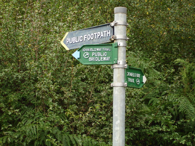
Image: © Robin Hall Taken: 22 Oct 2005
These point all over the place. The paths are clear but the pointers have been twisted around.
Images are licensed for reuse under creativecommons.org/licenses/by-sa/2.0
Image Location


Leaflet Map data © OpenStreetMap
Latitude
51.82797
Longitude
-0.525644