Tavistock Viaduct
Introduction
The photograph on this page of Tavistock Viaduct by Bob Walters as part of the Geograph project.
The Geograph project started in 2005 with the aim of publishing, organising and preserving representative images for every square kilometre of Great Britain, Ireland and the Isle of Man.

There are currently over 7.5m images from over 14,400 individuals and you can help contribute to the project by visiting https://www.geograph.org.uk
Tavistock Viaduct
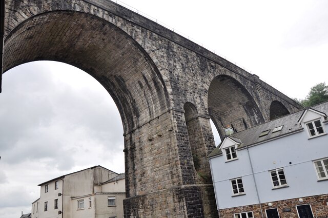
Image: © Bob Walters Taken: 29 Jul 2021
Tavistock Viaduct was part of the closed LSWR line from Exeter to Plymouth. This picture is taken from Taylor Square. The line was the London & South Western, later Southern Railway main line to Plymouth, closed in 1968. It has been suggested that this line should be re-opened to provide an alternative route to Plymouth and Cornwall as the old Great Western Railway route from Exeter to Plymouth is now the only access and can be subject to storm damage along the coast around Dawlish.
Images are licensed for reuse under creativecommons.org/licenses/by-sa/2.0
Image Location
Latitude
50.55116
Longitude
-4.147362