Field near Wester Hillhouse
Introduction
The photograph on this page of Field near Wester Hillhouse by Ian Dodds as part of the Geograph project.
The Geograph project started in 2005 with the aim of publishing, organising and preserving representative images for every square kilometre of Great Britain, Ireland and the Isle of Man.

There are currently over 7.5m images from over 14,400 individuals and you can help contribute to the project by visiting https://www.geograph.org.uk
Field near Wester Hillhouse
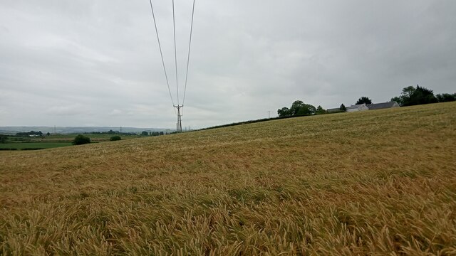
Image: © Ian Dodds Taken: 30 Jul 2021
The OS map today calls the buildings on the right 'Wester Hillhouse', and maps dating back almost 200 years refer to it as either this or 'West Hillhouse'. However, as Gordon Brown notes in another image of this square, the house sign today just reads 'Westerhill'. The land round here is fairly flat in the main but gradually rises from South of the Kilmarnock bypass to the small village of Craigie. This point is about halfway between the two. The fact that the overhead power line is shown on the map is surprising. I'm not sure what the OS's rules are regarding showing them on their larger-scale orange paper maps, but they don't seem very consistent. In West Lothian, where I have been walking and taking photographs the most in the last year or so, only the lines supported by huge pylons ever make it to the maps. These always show a small square at the position of the pylons, whereas on this smaller power line the pole positions get represented by dots.
Images are licensed for reuse under creativecommons.org/licenses/by-sa/2.0
Image Location
Latitude
55.570565
Longitude
-4.489334