Catherine Grove
Introduction
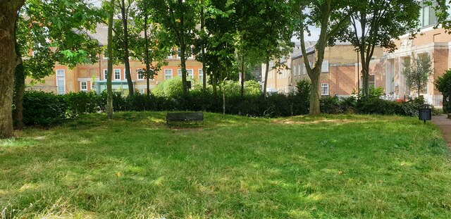
The photograph on this page of Catherine Grove by Nigel Jones as part of the Geograph project.
The Geograph project started in 2005 with the aim of publishing, organising and preserving representative images for every square kilometre of Great Britain, Ireland and the Isle of Man.
There are currently over 7.5m images from over 14,400 individuals and you can help contribute to the project by visiting https://www.geograph.org.uk

Image: © Nigel Jones Taken: 28 Jul 2021
View across the small public garden in Catherine Grove: straight ahead is Charter Buildings, the former Blackheath Road Higher Elementary School built in 1904 and now converted into flats, and on the far right is the Hilton Doubletree hotel, formerly Maurice Drummond House a police sector House built in 1946. The garden, responsibility for whose maintenance is not clear (the Royal Borough of Greenwich do not list it in their directory), is in a poor state and is rarely mowed or otherwise cared for. That said, local residents do tend one of the flower beds and occasionally prune the shrubs. Layers of London provides a full description of the street https://www.layersoflondon.org/map?l=eyJmcmVlX3RleHRfcXVlcnkiOm51bGwsInNlYXJjaF9wYWdlIjoxLCJjYXRlZ29yeV9hbmRfdGVybV9maWx0ZXJzIjp7InRlcm1faWQiOm51bGwsImNhdGVnb3J5X2lkIjoxfSwiYWN0aXZlX2xheWVyX2dyb3VwX2lkcyI6W119&m=eyJjZW50ZXIiOls1MS41MDc0LDAuMTI3OF0sInpvb20iOjEwLCJsaWdodHNPdXQiOmZhbHNlfQ%3D%3D&record=11760

