Direction Sign ? Signpost in Woodham Walter
Introduction
The photograph on this page of Direction Sign ? Signpost in Woodham Walter by John V Nicholls as part of the Geograph project.
The Geograph project started in 2005 with the aim of publishing, organising and preserving representative images for every square kilometre of Great Britain, Ireland and the Isle of Man.

There are currently over 7.5m images from over 14,400 individuals and you can help contribute to the project by visiting https://www.geograph.org.uk
Direction Sign ? Signpost in Woodham Walter
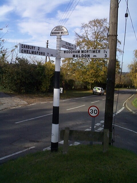
Image: © John V Nicholls Taken: Unknown
Located on the south side of the junction of Church Hill, Oak Farm Road and Herbage Park Road in Woodham Walter parish. 3 arms and half-moon finial. Milestone Society National ID: EX_TL8006B
Images are licensed for reuse under creativecommons.org/licenses/by-sa/2.0
Image Location


Leaflet Map data © OpenStreetMap
Latitude
51.729455
Longitude
0.617696