Nos 3 & 4, Dryton
Introduction
The photograph on this page of Nos 3 & 4, Dryton by Richard Law as part of the Geograph project.
The Geograph project started in 2005 with the aim of publishing, organising and preserving representative images for every square kilometre of Great Britain, Ireland and the Isle of Man.

There are currently over 7.5m images from over 14,400 individuals and you can help contribute to the project by visiting https://www.geograph.org.uk
Nos 3 & 4, Dryton
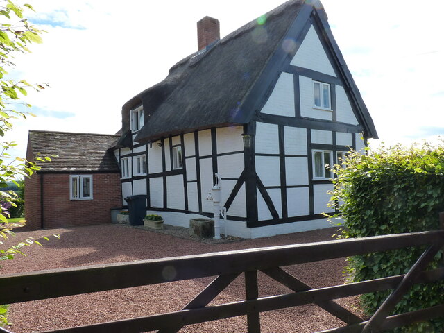
Image: © Richard Law Taken: 12 Jul 2020
A timber-framed, late 17th century cottage with 19th, 20th & 21st century alterations. It was Grade II listed https://britishlistedbuildings.co.uk/101223169-3-and-4-dryton-wroxeter-and-uppington#.YO4E_ehKjIU & https://historicengland.org.uk/listing/the-list/list-entry/1223169 in 1985.
Images are licensed for reuse under creativecommons.org/licenses/by-sa/2.0
Image Location
Latitude
52.649529
Longitude
-2.622269