Albany Road, Coventry
Introduction
The photograph on this page of Albany Road, Coventry by A J Paxton as part of the Geograph project.
The Geograph project started in 2005 with the aim of publishing, organising and preserving representative images for every square kilometre of Great Britain, Ireland and the Isle of Man.

There are currently over 7.5m images from over 14,400 individuals and you can help contribute to the project by visiting https://www.geograph.org.uk
Albany Road, Coventry
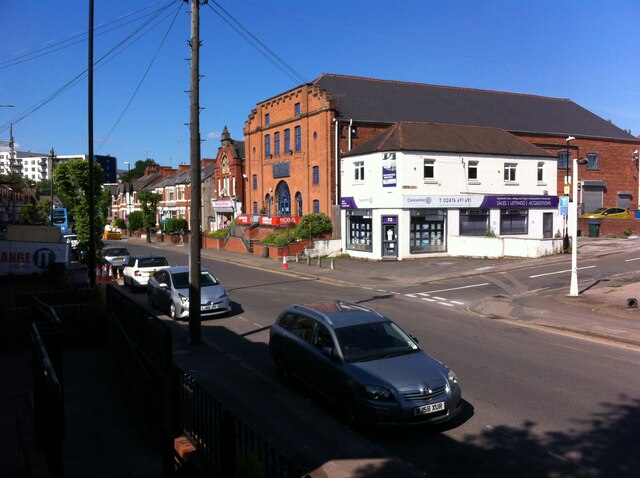
Image: © A J Paxton Taken: 12 Jun 2021
Albany Road was built in 1898 and named after the Duchess of Albany, who visited Coventry that year. The lower part, seen here, followed the route of the Earlsdon Jetty, a muddy and sometimes insanitary path that had connected Earlsdon to the Butts and Coventry. Buildings soon followed and also a tram service, which lasted until the second world war. http://www.earlsdon.org.uk/history/streets/albanyrd.html The photo is taken from the top of the steps on the path, by the upper of the two railway bridges, which leads to Westwood Road. Winifred Avenue can be seen leading off to the right. The large brick building behind the white property on the corner is the Nexus music academy. It was built in 1922 as the Broadway cinema and later renamed the Astoria before closing in 1959. http://cinematreasures.org/theaters/37913 The modern white block in the distance on the left is the Earlsdon Village development of retirement homes.
Images are licensed for reuse under creativecommons.org/licenses/by-sa/2.0
Image Location
Latitude
52.402394
Longitude
-1.526671