Old Boundary Marker on the A58 in Sowerby Bridge
Introduction
The photograph on this page of Old Boundary Marker on the A58 in Sowerby Bridge by R Heywood as part of the Geograph project.
The Geograph project started in 2005 with the aim of publishing, organising and preserving representative images for every square kilometre of Great Britain, Ireland and the Isle of Man.

There are currently over 7.5m images from over 14,400 individuals and you can help contribute to the project by visiting https://www.geograph.org.uk
Old Boundary Marker on the A58 in Sowerby Bridge
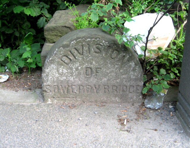
Image: © R Heywood Taken: 26 Jun 2021
Parish Boundary Marker in Sowerby Bridge on the southeast side of the A58 Rochdale Road opposite Jerry Lane. Inscribed DIVISION / OF / SOWERBY BRIDGE with more probably below ground level. On the former boundary of Sowerby Bridge and Sowerby. See also https://www.geograph.org.uk/photo/3467203. Milestone Society National ID: YW_SOWB07pb
Images are licensed for reuse under creativecommons.org/licenses/by-sa/2.0
Image Location
Latitude
53.703682
Longitude
-1.918149