Lyte's almshouses
Introduction
The photograph on this page of Lyte's almshouses by Neil Owen as part of the Geograph project.
The Geograph project started in 2005 with the aim of publishing, organising and preserving representative images for every square kilometre of Great Britain, Ireland and the Isle of Man.

There are currently over 7.5m images from over 14,400 individuals and you can help contribute to the project by visiting https://www.geograph.org.uk
Lyte's almshouses
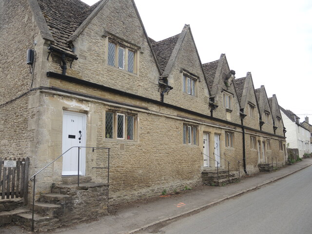
Image: © Neil Owen Taken: 29 May 2021
In 1612, Isaac Lyte (the grandfather of noted antiquarian John Aubrey) was born in the village. He later became an alderman of the City of London and left the princely sum of £600 for the construction of almshouses here. Completed in 1675, they were to provide a home for six poor unmarried men of the parishes of Kington St Michael and Kington Langley. Thus they remain almost unchanged, apart from the restoration of the 1960s, which added bathrooms; in 2008, extensions were made to assist disabled tennants.
Images are licensed for reuse under creativecommons.org/licenses/by-sa/2.0
Image Location


Leaflet Map data © OpenStreetMap
Latitude
51.495009
Longitude
-2.139676