Scotscraig Doocot
Introduction
The photograph on this page of Scotscraig Doocot by Ian Dodds as part of the Geograph project.
The Geograph project started in 2005 with the aim of publishing, organising and preserving representative images for every square kilometre of Great Britain, Ireland and the Isle of Man.

There are currently over 7.5m images from over 14,400 individuals and you can help contribute to the project by visiting https://www.geograph.org.uk
Scotscraig Doocot
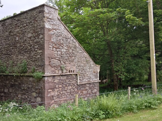
Image: © Ian Dodds Taken: 9 Jun 2021
A Category B listed building dating from the 1700s, this doocot (the Scottish word for dovecote, or dovecot) is described on its official listed building write-up as having a 'stepped rat course'. This not only is a term I have never come across before - there is also no mention of the term anywhere online. The author is obviously referring to the stonework protruding from the wall about halfway up the building. Anything along these lines is usually referred to in architecture as a string course. That is, apart from a handful of doocot descriptions available online. So the assumption has to be that they were necessary to stop actual rats shimmying up the wall and getting through the entrance holes to devour the pigeons inside. One article I found on the subject of rats eating pigeons said that they will if they can, and since pigeons are famous for eating whatever comes their way too, the tone of the piece seemed to be 'what goes around, comes around'! Incidentally pigeons are sometimes referred to as 'rats with wings'.
Images are licensed for reuse under creativecommons.org/licenses/by-sa/2.0
Image Location


Leaflet Map data © OpenStreetMap
Latitude
56.443242
Longitude
-2.900827