Priest's House, Prestbury
Introduction
The photograph on this page of Priest's House, Prestbury by Graham Hogg as part of the Geograph project.
The Geograph project started in 2005 with the aim of publishing, organising and preserving representative images for every square kilometre of Great Britain, Ireland and the Isle of Man.

There are currently over 7.5m images from over 14,400 individuals and you can help contribute to the project by visiting https://www.geograph.org.uk
Priest's House, Prestbury
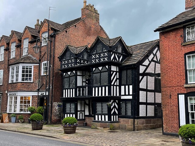
Image: © Graham Hogg Taken: 5 Jul 2021
Dating from the 16th century this grade II* listed timber framed building has been a vicarage, a cottage and more recently a bank. It currently appears to be unoccupied.
Images are licensed for reuse under creativecommons.org/licenses/by-sa/2.0
Image Location
Latitude
53.289419
Longitude
-2.151319