The Brocus
Introduction
The photograph on this page of The Brocus by Andy Potter as part of the Geograph project.
The Geograph project started in 2005 with the aim of publishing, organising and preserving representative images for every square kilometre of Great Britain, Ireland and the Isle of Man.

There are currently over 7.5m images from over 14,400 individuals and you can help contribute to the project by visiting https://www.geograph.org.uk
The Brocus
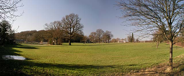
Image: © Andy Potter Taken: 12 Feb 2008
This field was bought by the village after the second world was as a memorial to the fallen of both wars. The Newdigate & Parkgate Cricket Club moved here from the green opposite Image shortly thereafter and renamed itself the Newdigate Cricket Club http://www.newdigatecricketclub.co.uk/. The playground behind Image is to the left with the cricket club just left of centre and the football pitch to the right. The Image and Image are at the extreme right.
Images are licensed for reuse under creativecommons.org/licenses/by-sa/2.0
Image Location
Latitude
51.167376
Longitude
-0.291917