In Stoke Bottom Lock, Stoke-on-Trent
Introduction
The photograph on this page of In Stoke Bottom Lock, Stoke-on-Trent by Roger Kidd as part of the Geograph project.
The Geograph project started in 2005 with the aim of publishing, organising and preserving representative images for every square kilometre of Great Britain, Ireland and the Isle of Man.

There are currently over 7.5m images from over 14,400 individuals and you can help contribute to the project by visiting https://www.geograph.org.uk
In Stoke Bottom Lock, Stoke-on-Trent
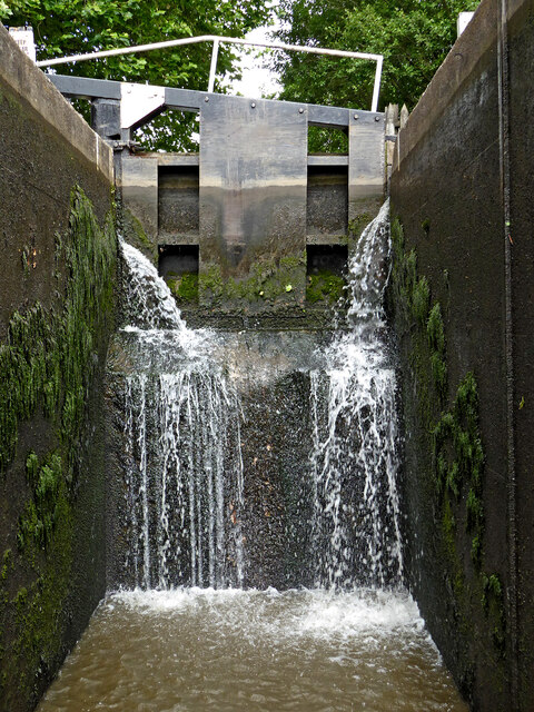
Image: © Roger Kidd Taken: 3 Aug 2015
Lock No 36 on the Trent and Mersey Canal. The lock provides a rise of ten feet (three metres). The Stoke flight of five locks provides a rise (or fall) of fifty feet (15·2 metres). Notice the big cill halfway up. Boaters descending through the lock MUST keep their stern forward of the white markers (just visible on both walls) as the water drains out of the lock. Failure to do this can result in the stern catching, the bow dipping, and potential sinking of the boat.
Images are licensed for reuse under creativecommons.org/licenses/by-sa/2.0
Image Location
Latitude
53.009994
Longitude
-2.18581