Direction Sign ? Signpost on the B1035 Heath Road, Tendring Green
Introduction
The photograph on this page of Direction Sign ? Signpost on the B1035 Heath Road, Tendring Green by John V Nicholls as part of the Geograph project.
The Geograph project started in 2005 with the aim of publishing, organising and preserving representative images for every square kilometre of Great Britain, Ireland and the Isle of Man.

There are currently over 7.5m images from over 14,400 individuals and you can help contribute to the project by visiting https://www.geograph.org.uk
Direction Sign ? Signpost on the B1035 Heath Road, Tendring Green
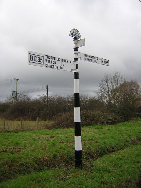
Image: © John V Nicholls Taken: 15 Mar 2004
Located at Tendring Green on the west side of the T junction of the B1035 Heath Road and Chapel Lane in Tendring parish. 3 arms, 1 missing, and half-moon finial. See also https://www.geograph.org.uk/photo/3205998. Milestone Society National ID: EX_TM1425
Images are licensed for reuse under creativecommons.org/licenses/by-sa/2.0
Image Location
Latitude
51.889223
Longitude
1.109478