Nisbet's Tower Eyemouth
Introduction
The photograph on this page of Nisbet's Tower Eyemouth by Jennifer Petrie as part of the Geograph project.
The Geograph project started in 2005 with the aim of publishing, organising and preserving representative images for every square kilometre of Great Britain, Ireland and the Isle of Man.

There are currently over 7.5m images from over 14,400 individuals and you can help contribute to the project by visiting https://www.geograph.org.uk
Nisbet's Tower Eyemouth
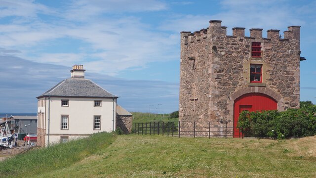
Image: © Jennifer Petrie Taken: 24 Jun 2021
Named after the local smuggler John Nisbet who had Gunsgreen House built in 1753. Nisbet's Tower is now used as a holiday cottage but was created from a renovated 18th century doo-cot. From up here there are wonderful views looking down on Eyemouth harbour. https://www.visitberwickshirecoast.co.uk/listings/gunsgreen-house/
Images are licensed for reuse under creativecommons.org/licenses/by-sa/2.0
Image Location
Latitude
55.871748
Longitude
-2.085471