Direction Sign ? Signpost on the B1026 in Layer-de-la-Haye
Introduction
The photograph on this page of Direction Sign ? Signpost on the B1026 in Layer-de-la-Haye by John V Nicholls as part of the Geograph project.
The Geograph project started in 2005 with the aim of publishing, organising and preserving representative images for every square kilometre of Great Britain, Ireland and the Isle of Man.

There are currently over 7.5m images from over 14,400 individuals and you can help contribute to the project by visiting https://www.geograph.org.uk
Direction Sign ? Signpost on the B1026 in Layer-de-la-Haye
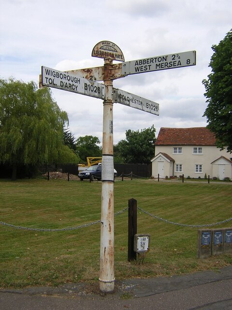
Image: © John V Nicholls Taken: Unknown
Located on the northwest side of the crossroads of the B1026 Church Road/High Road, Malting Green Road and Birch Road in Layer-de-la-Haye parish. 4 arms and half-moon finial. See also http://www.flickr.com/photos/13171205@N08/8283891835. Milestone Society National ID: EX_TL9620
Images are licensed for reuse under creativecommons.org/licenses/by-sa/2.0
Image Location
Latitude
51.844218
Longitude
0.854938