New flood defence wall, Wakefield Road, Brighouse
Introduction
The photograph on this page of New flood defence wall, Wakefield Road, Brighouse by Humphrey Bolton as part of the Geograph project.
The Geograph project started in 2005 with the aim of publishing, organising and preserving representative images for every square kilometre of Great Britain, Ireland and the Isle of Man.

There are currently over 7.5m images from over 14,400 individuals and you can help contribute to the project by visiting https://www.geograph.org.uk
New flood defence wall, Wakefield Road, Brighouse
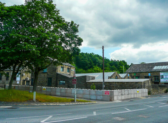
Image: © Humphrey Bolton Taken: 22 Jun 2021
There has often been flooding here from Clifton Beck, and the last time the parapet wall of the bridge was breached. The wall is on the left of this view Image This image shows the temporary sandbags Image Now we have a wall made of lego-style concrete blocks.
Images are licensed for reuse under creativecommons.org/licenses/by-sa/2.0
Image Location
Latitude
53.702143
Longitude
-1.775177