Path around edge of allotments behind Houldsworth Crescent, Holbrooks
Introduction
The photograph on this page of Path around edge of allotments behind Houldsworth Crescent, Holbrooks by A J Paxton as part of the Geograph project.
The Geograph project started in 2005 with the aim of publishing, organising and preserving representative images for every square kilometre of Great Britain, Ireland and the Isle of Man.

There are currently over 7.5m images from over 14,400 individuals and you can help contribute to the project by visiting https://www.geograph.org.uk
Path around edge of allotments behind Houldsworth Crescent, Holbrooks
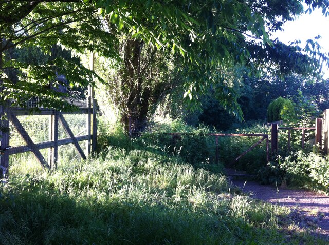
Image: © A J Paxton Taken: 15 Jun 2021
The gate to the allotments is to the left, the gate to the path straight ahead. The path turns to the left almost immediately and runs along the side of the allotments, which are bordered by a row of Lombardy poplars. To the right of the path is a small stream that emerges from a culvert among trees. The path continues to Blenheim Walk, a suburban street, then joins the Rookery Lane-Blackberry Lane path that crosses the disused mineral line and the approach road to Prologis Park and continues to Ash Green.
Images are licensed for reuse under creativecommons.org/licenses/by-sa/2.0
Image Location
Latitude
52.450263
Longitude
-1.514828