Demolishing Burns House
Introduction
The photograph on this page of Demolishing Burns House by Mary and Angus Hogg as part of the Geograph project.
The Geograph project started in 2005 with the aim of publishing, organising and preserving representative images for every square kilometre of Great Britain, Ireland and the Isle of Man.

There are currently over 7.5m images from over 14,400 individuals and you can help contribute to the project by visiting https://www.geograph.org.uk
Demolishing Burns House
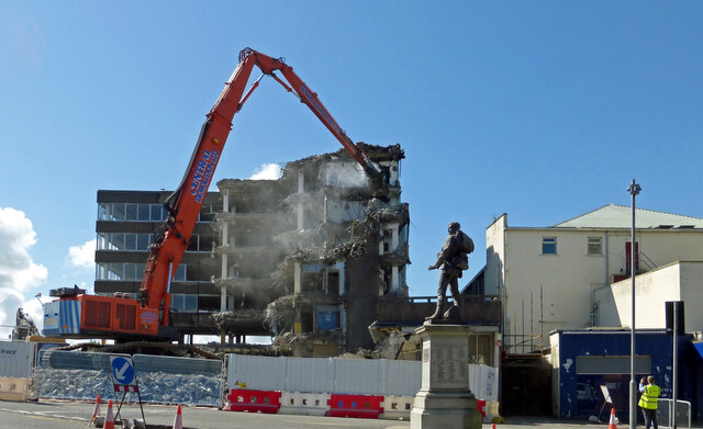
Image: © Mary and Angus Hogg Taken: 17 Jun 2021
Burns House was the HQ for Kyle & Carrick District Council, later accommodating the Planning Department for Strathclyde Regional Council. A worker and a number of by-standers were photographing the demolition work on the building. The Odeon Cinema next door is to remain in place.
Images are licensed for reuse under creativecommons.org/licenses/by-sa/2.0
Image Location
Latitude
55.457471
Longitude
-4.627729