Rocks near Lanemark
Introduction
The photograph on this page of Rocks near Lanemark by Mary and Angus Hogg as part of the Geograph project.
The Geograph project started in 2005 with the aim of publishing, organising and preserving representative images for every square kilometre of Great Britain, Ireland and the Isle of Man.

There are currently over 7.5m images from over 14,400 individuals and you can help contribute to the project by visiting https://www.geograph.org.uk
Rocks near Lanemark
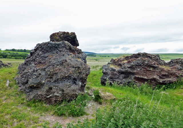
Image: © Mary and Angus Hogg Taken: 13 Jun 2021
The Landranger map shows a spoil heap in this area which is waste from the old Rigfoot No1 Colliery. A site visit showed impressively large blocks of waste which show signs of having been molten. The origin of the fire is not clear, possibly accidental, possibly a means of clearing the site when the mine was closed.
Images are licensed for reuse under creativecommons.org/licenses/by-sa/2.0
Image Location
Latitude
55.382556
Longitude
-4.241639