Eals from the South Tyne Trail
Introduction
The photograph on this page of Eals from the South Tyne Trail by James T M Towill as part of the Geograph project.
The Geograph project started in 2005 with the aim of publishing, organising and preserving representative images for every square kilometre of Great Britain, Ireland and the Isle of Man.

There are currently over 7.5m images from over 14,400 individuals and you can help contribute to the project by visiting https://www.geograph.org.uk
Eals from the South Tyne Trail
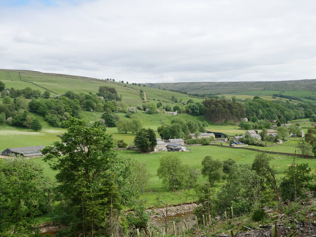
Image: © James T M Towill Taken: 13 Jun 2021
The hamlet of Eals in the South Tyne valley, viewed from the South Tyne Trail. The River South Tyne can just be seen at the bottom of shot. This photograph was taken during the Coronavirus (COVID-19) pandemic of 2020/21.
Images are licensed for reuse under creativecommons.org/licenses/by-sa/2.0
Image Location
Latitude
54.897962
Longitude
-2.501588