Thorpe under Stone
Introduction
The photograph on this page of Thorpe under Stone by Andy Waddington as part of the Geograph project.
The Geograph project started in 2005 with the aim of publishing, organising and preserving representative images for every square kilometre of Great Britain, Ireland and the Isle of Man.

There are currently over 7.5m images from over 14,400 individuals and you can help contribute to the project by visiting https://www.geograph.org.uk
Thorpe under Stone
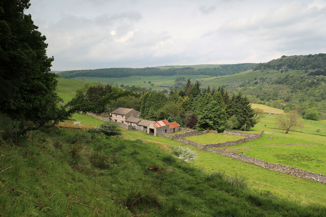
Image: © Andy Waddington Taken: 7 Jun 2021
The farm buildings of Thorpe under Stone lie within the military training area, but apart from odd warning signs round the periphery, there's nothing much to distinguish this from ordinary farmland and the sheep graze freely without being blown up. A public footpath descends from the Hudswell road to the main road in Swaledale, but as there are no continuations on the other sides of either road, it does not really form part of a longer walk, and seems little used. On the other hand, signposts invite one to traverse branch paths off both sides of the right of way marked on the map, despite signs at the roadheads advising walkers to stick to the public footpath.
Images are licensed for reuse under creativecommons.org/licenses/by-sa/2.0
Image Location
Latitude
54.40135
Longitude
-1.811579