Path to Thorpe under Stone
Introduction
The photograph on this page of Path to Thorpe under Stone by Andy Waddington as part of the Geograph project.
The Geograph project started in 2005 with the aim of publishing, organising and preserving representative images for every square kilometre of Great Britain, Ireland and the Isle of Man.

There are currently over 7.5m images from over 14,400 individuals and you can help contribute to the project by visiting https://www.geograph.org.uk
Path to Thorpe under Stone
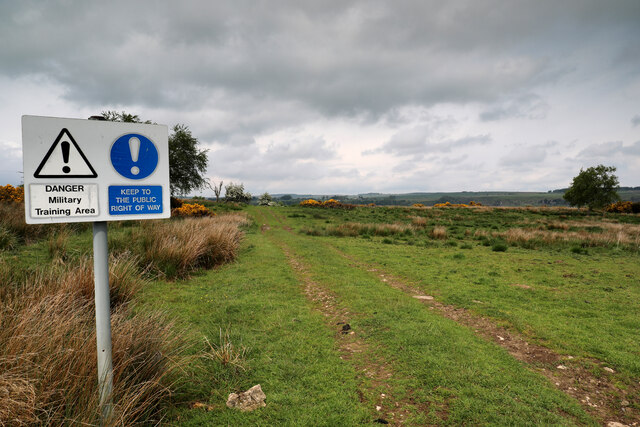
Image: © Andy Waddington Taken: 7 Jun 2021
Although it starts out as a substantial track, beyond Thorpe under Stone, this footpath leads only to the main road in Swaledale where there are no other paths leading on, and is thus little used by walkers, rapidly becoming fainter beyond the next gate. Sheep and other livestock wander freely, and whilst it is a military training area, I don't think it sees much live shooting. Interestingly, although this is the only right of way marked on the map, and the Army seem keen that you don't stray from it, once within the area, signposts suggest a number of other paths branching off to left and right.
Images are licensed for reuse under creativecommons.org/licenses/by-sa/2.0
Image Location
Latitude
54.397377
Longitude
-1.800353