Dropping in to Roundthwaite
Introduction
The photograph on this page of Dropping in to Roundthwaite by Andy Waddington as part of the Geograph project.
The Geograph project started in 2005 with the aim of publishing, organising and preserving representative images for every square kilometre of Great Britain, Ireland and the Isle of Man.

There are currently over 7.5m images from over 14,400 individuals and you can help contribute to the project by visiting https://www.geograph.org.uk
Dropping in to Roundthwaite
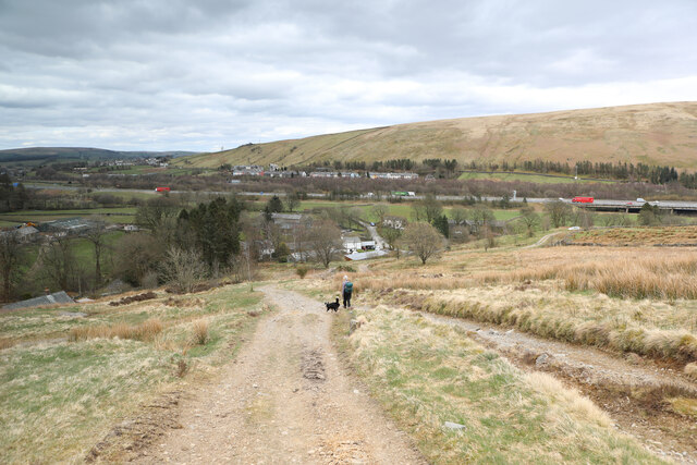
Image: © Andy Waddington Taken: 7 Apr 2021
From Low Borrowdale, the bridleway is pretty vague for a couple of kilometres before picking up a track for the next couple. The track stays high above the right bank of Roundthwaite Beck until it rounds the end of the spur northeast of Jeffrey's mount whereupon it drops steeply to the road just east of the village where there is handy parking for a couple of cars, enabling visiting walkers to remain safely socially distanced from the local population. This final stretch of the route is a brutal return to civilisation as the major transport corridor of the Lune Valley carries not only the West Coast Main Line, but also (and much more visibly) the noisy M6 motorway. Across the valley lies Tebay.
Images are licensed for reuse under creativecommons.org/licenses/by-sa/2.0
Image Location
Latitude
54.423706
Longitude
-2.604896