Larpool Viaduct, near Whitby
Introduction
The photograph on this page of Larpool Viaduct, near Whitby by Malc McDonald as part of the Geograph project.
The Geograph project started in 2005 with the aim of publishing, organising and preserving representative images for every square kilometre of Great Britain, Ireland and the Isle of Man.

There are currently over 7.5m images from over 14,400 individuals and you can help contribute to the project by visiting https://www.geograph.org.uk
Larpool Viaduct, near Whitby
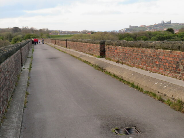
Image: © Malc McDonald Taken: 24 Apr 2021
Larpool viaduct, built to carry a railway line into Whitby, now forms part of the route of National Cycle Network route 1. The route is also part of the Cinder Track, a path linking Whitby with Scarborough along the former railway route. Whitby Abbey is visible in this image, on the hilltop to the right of the image.
Images are licensed for reuse under creativecommons.org/licenses/by-sa/2.0
Image Location


Leaflet Map data © OpenStreetMap
Latitude
54.473591
Longitude
-0.618707