Priory Barn, Thurgarton
Introduction
The photograph on this page of Priory Barn, Thurgarton by Alan Murray-Rust as part of the Geograph project.
The Geograph project started in 2005 with the aim of publishing, organising and preserving representative images for every square kilometre of Great Britain, Ireland and the Isle of Man.

There are currently over 7.5m images from over 14,400 individuals and you can help contribute to the project by visiting https://www.geograph.org.uk
Priory Barn, Thurgarton
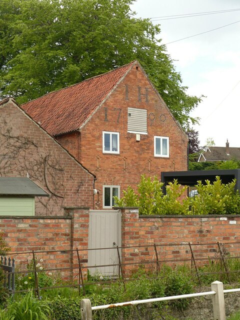
Image: © Alan Murray-Rust Taken: 19 May 2021
Late 18th century threshing barn with a fine set of lettering, converted to residential use. Priory Farm ceased agricultural operation in the mid 20th century.
Images are licensed for reuse under creativecommons.org/licenses/by-sa/2.0
Image Location
Latitude
53.035487
Longitude
-0.965455