York Road, London, in 1989
Introduction
The photograph on this page of York Road, London, in 1989 by Christopher Hilton as part of the Geograph project.
The Geograph project started in 2005 with the aim of publishing, organising and preserving representative images for every square kilometre of Great Britain, Ireland and the Isle of Man.

There are currently over 7.5m images from over 14,400 individuals and you can help contribute to the project by visiting https://www.geograph.org.uk
York Road, London, in 1989
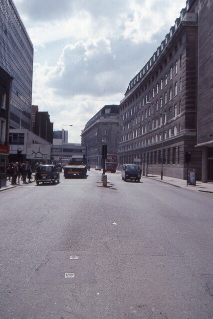
Image: © Christopher Hilton Taken: 13 Apr 1989
On the right, County Hall North Block and, further off, South Block; from the latter comes the bridge to Island Block, invisible behind the buildings to the left but at that time taking up the centre of the roundabout we see signposted. On the extreme left, a Victorian building (now demolished) hangs on in the space between office blocks. Island Block can be seen (from the Westminster Bridge direction) in Image
Images are licensed for reuse under creativecommons.org/licenses/by-sa/2.0
Image Location
Latitude
51.502009
Longitude
-0.116908