Entrance gateway to Prideaux Place
Introduction
The photograph on this page of Entrance gateway to Prideaux Place by Derek Harper as part of the Geograph project.
The Geograph project started in 2005 with the aim of publishing, organising and preserving representative images for every square kilometre of Great Britain, Ireland and the Isle of Man.

There are currently over 7.5m images from over 14,400 individuals and you can help contribute to the project by visiting https://www.geograph.org.uk
Entrance gateway to Prideaux Place
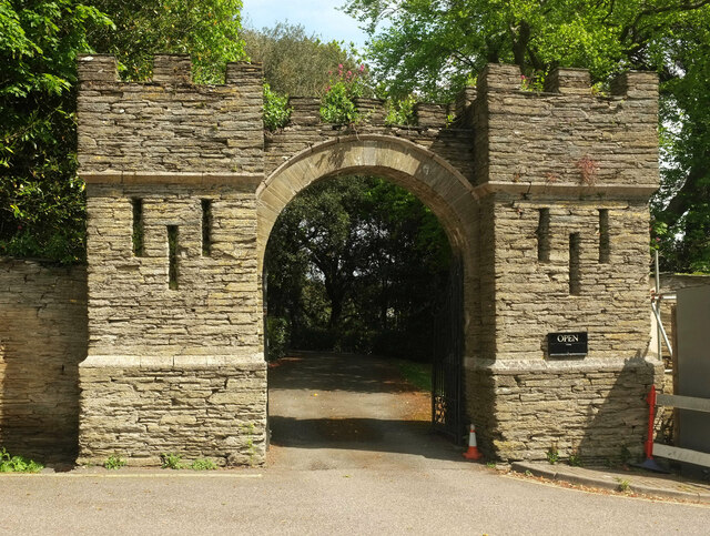
Image: © Derek Harper Taken: 17 May 2021
Grade II* listed: "Circa C18, pre 1758. Slate stone rubble ... Semi-circular dressed stone arch to entrance, with crenellations above, flanked by 2 square crenellated turrets with narrow slits and moulded plinths ..."
Images are licensed for reuse under creativecommons.org/licenses/by-sa/2.0
Image Location


Leaflet Map data © OpenStreetMap
Latitude
50.541343
Longitude
-4.94539