Old mine shaft in a field
Introduction
The photograph on this page of Old mine shaft in a field by Gordon Hatton as part of the Geograph project.
The Geograph project started in 2005 with the aim of publishing, organising and preserving representative images for every square kilometre of Great Britain, Ireland and the Isle of Man.

There are currently over 7.5m images from over 14,400 individuals and you can help contribute to the project by visiting https://www.geograph.org.uk
Old mine shaft in a field
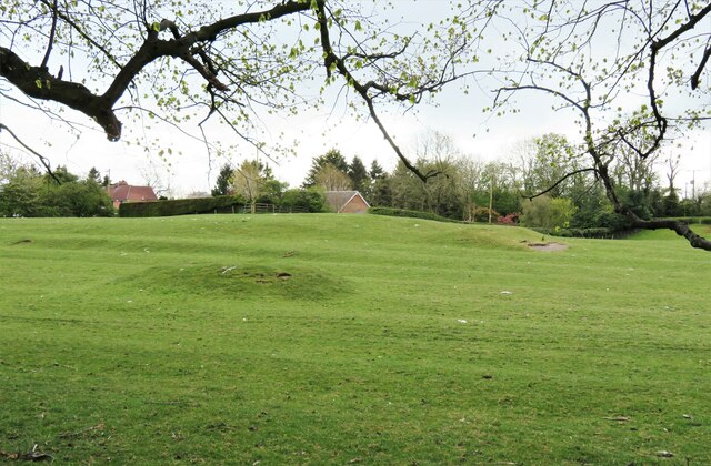
Image: © Gordon Hatton Taken: 6 May 2021
There are several such bowl shaped shafts close to the parish church at Middleton Tyas. They are remnants of a short lived copper mining boom that lasted barely 40 years in the mid 18th century. Further west in Swaledale one expects to see remains of the lead mining industry, but east of Marrick towards Hudswell and Richmond lead dies out to be replaced by copper which appears along faults in the underlying carboniferous rocks. These rocks extend as far east as Middleton Tyas, and although the copper ore found here was of high quality, there wasn't much of it, thus the short period of extraction. Beyond the shaft in the picture there appears to be a grassed over spoil heap.
Images are licensed for reuse under creativecommons.org/licenses/by-sa/2.0
Image Location
Latitude
54.445814
Longitude
-1.642521