Westbury ways [9]
Introduction
The photograph on this page of Westbury ways [9] by Michael Dibb as part of the Geograph project.
The Geograph project started in 2005 with the aim of publishing, organising and preserving representative images for every square kilometre of Great Britain, Ireland and the Isle of Man.

There are currently over 7.5m images from over 14,400 individuals and you can help contribute to the project by visiting https://www.geograph.org.uk
Westbury ways [9]
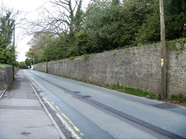
Image: © Michael Dibb Taken: 29 Apr 2021
Laverton Road runs from Warminster Road to Leigh Road. The wall topped with razor wire on the right of the road is the boundary wall to the Leighton House estate. The estate is occupied by the Army Officer Selection Board, an assessment centre used by the British Army as part of the officer selection process for the regular army and Army Reserve. The 40 acre estate comprises the grade II* listed, 19th century Leighton House, a trout lake and an assault course where potential officers are put through their paces. The estate is due to be sold for housing in 2024. The Leighton House estate is occupied by the Army Officer Selection Board, an assessment centre used by the British Army as part of the officer selection process for the regular army and Army Reserve. The 40 acre estate comprises the grade II* listed, 19th century Leighton House, a trout lake and an assault course where potential officers are put through their paces. The estate is due to be sold for housing in 2024. Westbury is a former market town in the far west of Wiltshire under the north western edge of Salisbury Plain, 4 miles south of Trowbridge and 4 miles north of Warminster. Westbury was a centre of the cloth industry from the later 15th century until the 19th century. Malting was another important industry. There are now a number of large industrial and trading estates around the town with many residents working there. The town is an important junction point on the railway network with the Reading to Taunton line intersecting the line from Bristol to Southampton.
Images are licensed for reuse under creativecommons.org/licenses/by-sa/2.0
Image Location
Latitude
51.250721
Longitude
-2.192234