Row of shops facing onto a green on Everdon Road, Coventry
Introduction
The photograph on this page of Row of shops facing onto a green on Everdon Road, Coventry by A J Paxton as part of the Geograph project.
The Geograph project started in 2005 with the aim of publishing, organising and preserving representative images for every square kilometre of Great Britain, Ireland and the Isle of Man.

There are currently over 7.5m images from over 14,400 individuals and you can help contribute to the project by visiting https://www.geograph.org.uk
Row of shops facing onto a green on Everdon Road, Coventry
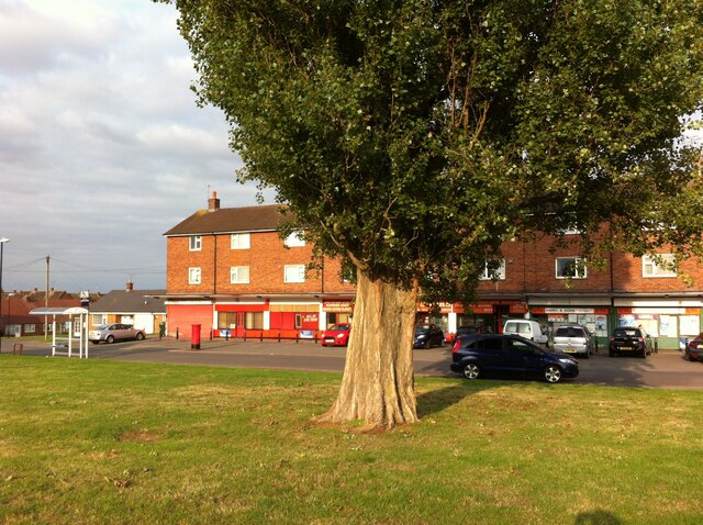
Image: © A J Paxton Taken: 28 Aug 2018
Everdon Road is a street of council housing built by Coventry City Council, probably in the late 1950s or early 1960s. It is oval in shape, with a short connecting road joining it to Holbrook Lane to the east, and has smaller closes branching off, forming a housing estate, for which this row of shops was intended as a shopping centre. It faces onto a green with a single lombardy poplar, at the western end of Everdon Road where it connects to Charlewood Road.
Images are licensed for reuse under creativecommons.org/licenses/by-sa/2.0
Image Location
Latitude
52.440742
Longitude
-1.516845