Micklebrack, off Back Lane
Introduction
The photograph on this page of Micklebrack, off Back Lane by Gordon Hatton as part of the Geograph project.
The Geograph project started in 2005 with the aim of publishing, organising and preserving representative images for every square kilometre of Great Britain, Ireland and the Isle of Man.

There are currently over 7.5m images from over 14,400 individuals and you can help contribute to the project by visiting https://www.geograph.org.uk
Micklebrack, off Back Lane
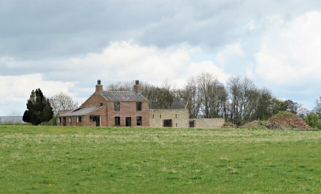
Image: © Gordon Hatton Taken: 29 Apr 2021
Difficult to assess what is going on with this set of buildings. Micklebrack is certainly a farmhouse that has been around for some time as it is shown on first edition six inch maps, so is this the original farmhouse undergoing some sort of reconstruction? Magnifying the image shows interior thermal block walls, so one assumes that this is the case.
Images are licensed for reuse under creativecommons.org/licenses/by-sa/2.0
Image Location
Latitude
54.302603
Longitude
-1.573227