Old Wayside Cross at the junction of Castle Street, Old Callywith Road and Roselands Road, Bodmin
Introduction
The photograph on this page of Old Wayside Cross at the junction of Castle Street, Old Callywith Road and Roselands Road, Bodmin by L Nott as part of the Geograph project.
The Geograph project started in 2005 with the aim of publishing, organising and preserving representative images for every square kilometre of Great Britain, Ireland and the Isle of Man.

There are currently over 7.5m images from over 14,400 individuals and you can help contribute to the project by visiting https://www.geograph.org.uk
Old Wayside Cross at the junction of Castle Street, Old Callywith Road and Roselands Road, Bodmin
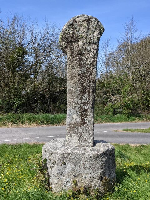
Image: © L Nott Taken: 24 Apr 2021
Castle Street Hill Cross, a wayside cross with an old head and shaft. Set on a grass triangle at the junction of Castle Street, Old Callywith Road and Roselands Road in Bodmin parish. Grade II Listed https://historicengland.org.uk/listing/the-list/list-entry/1195252. See also http://www.geograph.org.uk/photo/757140, https://www.geograph.org.uk/photo/4285026 and http://www.flickr.com/photos/ocifant/2879459265. Milestone Society National ID: CWNC_BOD08
Images are licensed for reuse under creativecommons.org/licenses/by-sa/2.0
Image Location
Latitude
50.476098
Longitude
-4.709452