Trowbridge houses [20]
Introduction
The photograph on this page of Trowbridge houses [20] by Michael Dibb as part of the Geograph project.
The Geograph project started in 2005 with the aim of publishing, organising and preserving representative images for every square kilometre of Great Britain, Ireland and the Isle of Man.

There are currently over 7.5m images from over 14,400 individuals and you can help contribute to the project by visiting https://www.geograph.org.uk
Trowbridge houses [20]
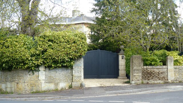
Image: © Michael Dibb Taken: 11 Apr 2021
Glimpsed behind its gate is The Grange, a large mid 19th century suburban villa in a mixture of classical and Italianate styles. Constructed with a central projecting entrance porch in ashlar under slate roofs. Listed, grade I, with details at: https://historicengland.org.uk/listing/the-list/list-entry/1198803 The rubble stone garden walls and vermiculated gate piers are mid 19th century. Listed, grade II, with details at: https://historicengland.org.uk/listing/the-list/list-entry/1021669 A market town and county town of Wiltshire, Trowbridge lies on the River Biss, 6 miles (10 kilometres) south of Bath. The town developed as a centre for woollen cloth production from the 14th century, which from the 17th century became increasingly industrialized, so much so that, in 1820, Trowbridge was described as the "Manchester of the West" with over 20 woollen cloth producing factories. The Kennet and Avon Canal runs just to the north of the town and both the Wessex Main Line (Bristol–Westbury–Southampton) and the Heart of Wessex Line (Bristol–Westbury–Weymouth) railways serve the station.
Images are licensed for reuse under creativecommons.org/licenses/by-sa/2.0
Image Location
Latitude
51.327777
Longitude
-2.194422