Barn at Water Farm, Shelford
Introduction
The photograph on this page of Barn at Water Farm, Shelford by Alan Murray-Rust as part of the Geograph project.
The Geograph project started in 2005 with the aim of publishing, organising and preserving representative images for every square kilometre of Great Britain, Ireland and the Isle of Man.

There are currently over 7.5m images from over 14,400 individuals and you can help contribute to the project by visiting https://www.geograph.org.uk
Barn at Water Farm, Shelford
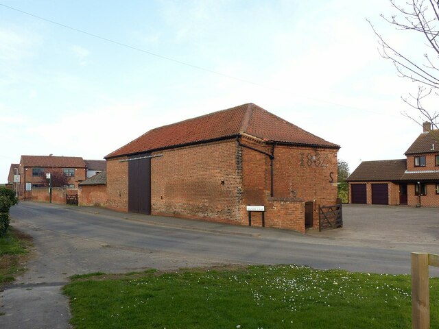
Image: © Alan Murray-Rust Taken: 4 Apr 2021
Probably early 19th century, with lean-to extension dated 1834, Listed Grade II. The hipped roof is characteristic of the farms in the village http://www.geograph.org.uk/photo/6803831 http://www.geograph.org.uk/photo/6803733 , all of which formed part of the estate of the Stanhope family, later Earls of Carnarvon.
Images are licensed for reuse under creativecommons.org/licenses/by-sa/2.0
Image Location
Latitude
52.975117
Longitude
-1.012468