Barnham Broom village sign
Introduction
The photograph on this page of Barnham Broom village sign by Adrian S Pye as part of the Geograph project.
The Geograph project started in 2005 with the aim of publishing, organising and preserving representative images for every square kilometre of Great Britain, Ireland and the Isle of Man.

There are currently over 7.5m images from over 14,400 individuals and you can help contribute to the project by visiting https://www.geograph.org.uk
Barnham Broom village sign
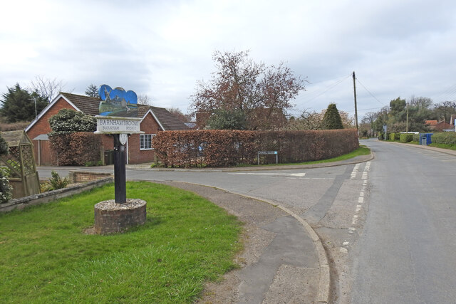
Image: © Adrian S Pye Taken: 8 Apr 2021
The 'Broom' part was added in 1838, before that it was just plain old Barnham or Bernham. Ryske was another village/hamlet which was deserted in the early 1500s when Sir Edward Chamberlayne created a private estate and started building Ryskes Hall, it was completed in about 1550. The sign features a windmill which stood just east of the watermill, the building central in the picture which took its power from the River Yare. A ploughman and his horse are shown on the near-side of the river representative of the long agricultural heritage of the parish. The sign was erected in 1977, for the Queen’s silver jubilee. https://www.geograph.org.uk/photo/6803777
Images are licensed for reuse under creativecommons.org/licenses/by-sa/2.0
Image Location
Latitude
52.623971
Longitude
1.080042