
Substantial Gateposts opposite Threemiletown Farmhouse
Introduction
The photograph on this page of Substantial Gateposts opposite Threemiletown Farmhouse by Ian Dodds as part of the Geograph project.
The Geograph project started in 2005 with the aim of publishing, organising and preserving representative images for every square kilometre of Great Britain, Ireland and the Isle of Man.

There are currently over 7.5m images from over 14,400 individuals and you can help contribute to the project by visiting https://www.geograph.org.uk
Substantial Gateposts opposite Threemiletown Farmhouse
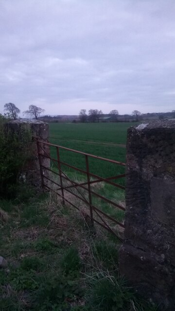
Image: © Ian Dodds Taken: 2 Apr 2021
At about four foot high, and two foot by one and a half foot wide, these gateposts looked unnecessarily grand for a plain old field entrance. The first OS map of the area, from the 1850s, shows nothing, but Forest's Linlithgowshire (the old formal name for West Lothian) county map of 1818 appears to show some kind of fancy garden occupying a small portion of the field behind the gate. It wasn't particularly big, as no paths are shown, but am pretty sure that's what the map is depicting - anything shown as natural and rectangular split into smaller rectangles on these surprisingly detailed old maps generally seems to denote a purposefully cultivated garden. The farmhouse and steading, for which there is an exhaustive architectural write-up on the Historic Scotland website, was once part of the sprawling Hopetoun Estate. The house and its steading have now been incorporated into a very upmarket cul-de-sac called Canal Court- a bit of a lazy name considering the canal is over half a mile further North!
Images are licensed for reuse under creativecommons.org/licenses/by-sa/2.0
Image Location

Latitude
55.965054
Longitude
-3.509029