Railway Bridge, Westcourt Drive, Bexhill-on-Sea
Introduction
The photograph on this page of Railway Bridge, Westcourt Drive, Bexhill-on-Sea by Bill Johnson as part of the Geograph project.
The Geograph project started in 2005 with the aim of publishing, organising and preserving representative images for every square kilometre of Great Britain, Ireland and the Isle of Man.

There are currently over 7.5m images from over 14,400 individuals and you can help contribute to the project by visiting https://www.geograph.org.uk
Railway Bridge, Westcourt Drive, Bexhill-on-Sea
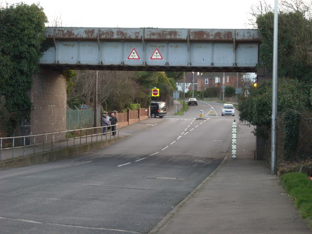
Image: © Bill Johnson Taken: 24 Jan 2008
The significant feature of this photograph is the white post on the right hand kerb. The road is prone to flooding at this point and the white post lets those motorists who have stalled in the flood water know exactly how deep it is at that point.
Images are licensed for reuse under creativecommons.org/licenses/by-sa/2.0
Image Location
Latitude
50.83844
Longitude
0.452803