Benchmark(s) on wall of St James Park, north side of Norfolk Street
Introduction
The photograph on this page of Benchmark(s) on wall of St James Park, north side of Norfolk Street by Roger Templeman as part of the Geograph project.
The Geograph project started in 2005 with the aim of publishing, organising and preserving representative images for every square kilometre of Great Britain, Ireland and the Isle of Man.

There are currently over 7.5m images from over 14,400 individuals and you can help contribute to the project by visiting https://www.geograph.org.uk
Benchmark(s) on wall of St James Park, north side of Norfolk Street
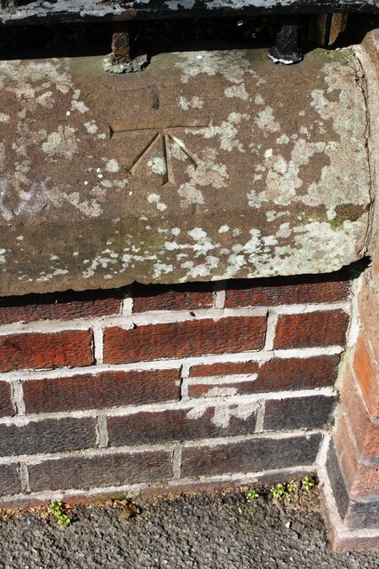
Image: © Roger Templeman Taken: 19 Aug 2019
The mark in the bricks is an Ordnance Survey cut mark benchmark described on the Bench Mark Database at www.bench-marks.org.uk/bm68950. I don't know the significance of the mark on the coping stone
Images are licensed for reuse under creativecommons.org/licenses/by-sa/2.0
Image Location
Latitude
54.885345
Longitude
-2.945228