Kinson: Markham Avenue
Introduction
The photograph on this page of Kinson: Markham Avenue by Chris Downer as part of the Geograph project.
The Geograph project started in 2005 with the aim of publishing, organising and preserving representative images for every square kilometre of Great Britain, Ireland and the Isle of Man.

There are currently over 7.5m images from over 14,400 individuals and you can help contribute to the project by visiting https://www.geograph.org.uk
Kinson: Markham Avenue
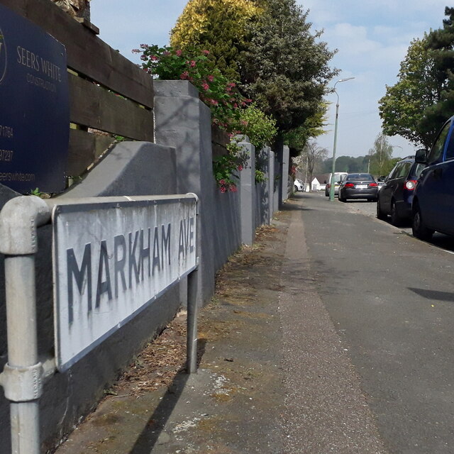
Image: © Chris Downer Taken: 12 Apr 2020
One of three dead ends that head north from Kinson Park Road, at the very northern extreme of Bournemouth suburbs. The other two, Castleton and North Avenues, end abruptly with a hedge, as if they might have been planned to continue one day – but Markham Avenue ends more deliberately with a turning circle and its bungalows surrounding it. The sign is the standard Bournemouth nameplate from the 1980s, affixed with tubular steel which protrudes at each side. It is surprising that a no-through-road sign is not either incorporated into the sign or standing alongside it, both of which are common arrangements. This is photo no.261 of a series of 453 in my coronavirus lockdown walking project: See https://www.geograph.org.uk/article/My-2020-Coronavirus-Lockdown-walking-project for the complete set of photos.
Images are licensed for reuse under creativecommons.org/licenses/by-sa/2.0
Image Location
Latitude
50.771903
Longitude
-1.890893