Cerne Abbas buildings [3]
Introduction
The photograph on this page of Cerne Abbas buildings [3] by Michael Dibb as part of the Geograph project.
The Geograph project started in 2005 with the aim of publishing, organising and preserving representative images for every square kilometre of Great Britain, Ireland and the Isle of Man.

There are currently over 7.5m images from over 14,400 individuals and you can help contribute to the project by visiting https://www.geograph.org.uk
Cerne Abbas buildings [3]
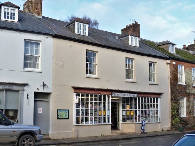
Image: © Michael Dibb Taken: 11 Dec 2020
Cerne Abbas Stores, number 9 Long Street is 18th century and was mostly rebuilt in the late 1830s following a fire. Rendered rubble stone walls. Listed, grade II, with details at: https://historicengland.org.uk/listing/the-list/list-entry/1119443 There is an interesting history of the house at page 18 of the Cerne Historical Society's publication A Short Anecdotal History of Cerne Abbas at: https://cerneabbashistory.org/house-history/ Cerne Abbas is a village on the banks of the River Cerne, some 10 miles north of Dorchester. The village grew around the Benedictine abbey which was founded in 987 and thrived after the dissolution as a small market town renowned for the quality of the beer brewed there. At one time there were 15 public houses for a population of 1,500. Now the economy of the village is dominated by tourism with thousands of visitors drawn to see the world famous Giant – a chalk figure 180 feet high.
Images are licensed for reuse under creativecommons.org/licenses/by-sa/2.0
Image Location
Latitude
50.808836
Longitude
-2.47696