Stone, opposite the Old Gate Inn
Introduction
The photograph on this page of Stone, opposite the Old Gate Inn by Peter Collins as part of the Geograph project.
The Geograph project started in 2005 with the aim of publishing, organising and preserving representative images for every square kilometre of Great Britain, Ireland and the Isle of Man.

There are currently over 7.5m images from over 14,400 individuals and you can help contribute to the project by visiting https://www.geograph.org.uk
Stone, opposite the Old Gate Inn
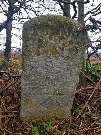
Image: © Peter Collins Taken: 16 Mar 2021
A2050. Marked as a stone on 1896 maps but may well have been a milestone at sometime during the turnpike years. Benchmark listed as 171.1 ft Above Sea Level in 1872/96 but in the 1960s as 169.9 ft ASL.
Images are licensed for reuse under creativecommons.org/licenses/by-sa/2.0
Image Location
Latitude
51.261986
Longitude
1.103319